


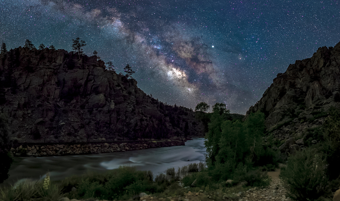
Guarding the headwaters of the Arkansas River, the towering granite walls of Browns Canyon National Monument stretch between the communities of Buena Vista and Salida in Chaffee County, Colorado. Ranging between 7,300 feet and 10,000 feet in elevation, the monument offers astonishing views of central Colorado’s Arkansas Valley and the Sawatch Range of the Rocky Mountains.
The monument includes 11,836 acres of the San Isabel National Forest and 9,750 acres administered by the Bureau of Land Management. This pristine location represents the ninth monument managed by the U.S. Department of Agriculture Forest Service and the 21st managed by the Bureau of Land Management, and contains numerous recreational opportunities, including rafting, fishing, kayaking, mountain biking, horseback riding, hiking, photography, and stargazing.
Browns Canyon is steeped in a rich archeological history, and the area holds deep significance to Indigenous Tribal communities. The monument is also home to some of the most emblematic wildlife of the Rocky Mountains, including bighorn sheep, mule deer, elk, American black bear, bobcat, mountain lion, coyote, red fox, and American pine marten.
A local non-profit, Friends of Browns Canyon led the DarkSky International application process. They hosted night sky events, including fundraisers, concerts and photography outings. The group also conducted light meter readings and hired a contractor to assist them in developing the application. Using this information, management agencies revised lighting standards to ensure the best possible viewing for stargazers, and are now training staff to deliver night sky education and programming to visitors on the area’s expanded recreation options.
When the monument’s staff realized that the existing lighting around the restroom facilities did not meet the requirements for the Lighting Management Policy, staff member, Brad Sherman, from Colorado Parks and Wildlife (CPW) teamed up with Michael Kunkel of The Friends of Browns Canyon to engineer and fabricate a shield that would specifically fit over each of the lighting fixtures. The two had spent many months working on this specific project and many prototypes. Finally, after a few trials and errors, their collaboration paid off and they came up with a design that was durable and easy to install in order to bring Browns Canyon National Monument into compliance with the Lighting Management Policy.
The most popular route to access the monument is by floating down the river’s class 3 rapids, or hiking the Turret trail. Ruby Mountain and Hecla Junction campgrounds offer excellent camping and viewing of the night skies. The monument can also be accessed from the Fourmile Travel Management Area on the San Isabel National Forest.
Access points include Forest Service Trail #1434, Forest Service Road 185.D and Forest Service Road 184, which follow along the northern edge of the monument. Forest Service Road 185, also known as Aspen Ridge Road, follows the eastern edge of the monument and offers breathtaking views of the Sawatch Mountain Range and spectacular fall foliage. Forest Service Road 184, also known as Turret Road, is a rugged dirt road that takes visitors deep into the monument. A high-clearance vehicle with four-wheel drive is recommended. For a map of the Browns Canyon National Monument, visit https://brownscanyon.org/plan-your-visit/maps/.
89.03 Sq. Km
2024
International Dark Sky Park
Ruby Campground
County Road 301
Nathrop, CO 81236
Google Maps
Kalem Lenard
Browns Canyon National Monument Manager
Bureau of Land Management
Gabe Hobson
Recreation Manager
Salida Ranger District
Tom Waters
Park Manager
Arkansas Headwaters Recreation Area
Application
Announcement
Annual Reports
Click here to find ideal environmental conditions for viewing the night sky Browns Canyon National Monument. Don’t forget to plan your trip during the new moon and after astronomical twilight to enhance the viewing experience!